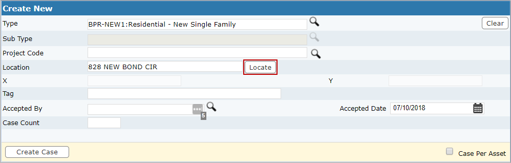
Geocode a Location
When you enter an address and select Locate, the case is geocoded to the X and Y coordinates on the map. Geocoding gives you the opportunity to pinpoint a specific address or parcel making it easier to visually compare, map, calculate, and analyze data.
- On the Create New and Main panels, enter an address and
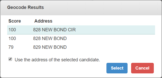
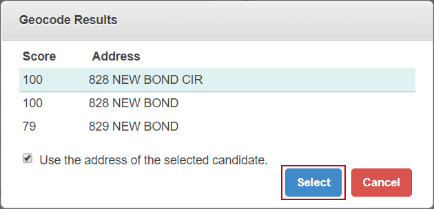
- Select the desired address from the list.
This geocodes the address to the case without having to open the map. However, if the map is already open,
- Select Use the address of the selected candidate to update to the selected address and its X and Y coordinates. If you do not select this check box, it still updates the X and Y coordinates but does not update the address.
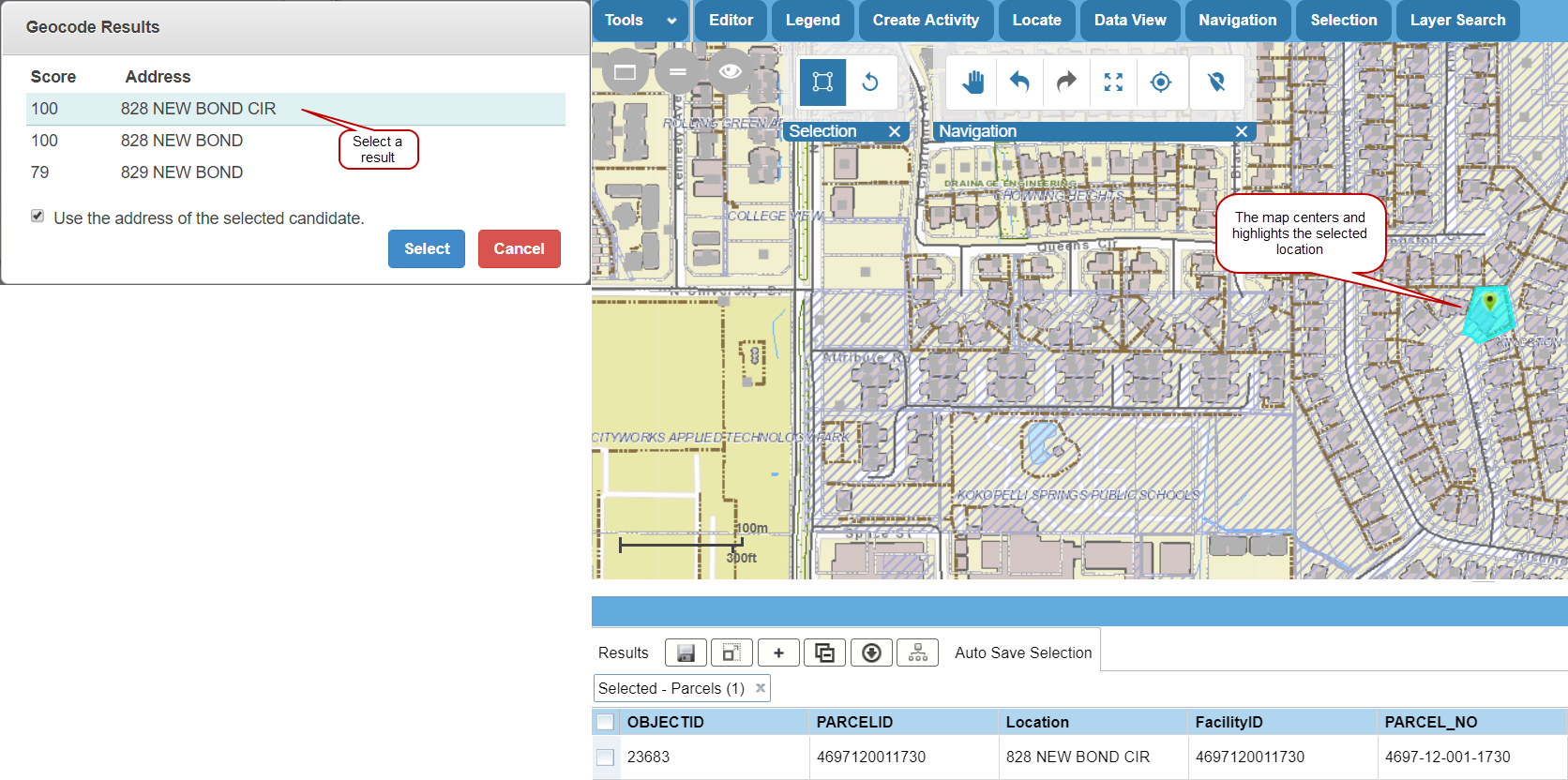
- After you've selected an address,
A map pin appears on the map.
 NOTE: Score is an Esri-calculated value that shows how closely the value entered matches the parameters defined by Esri.